
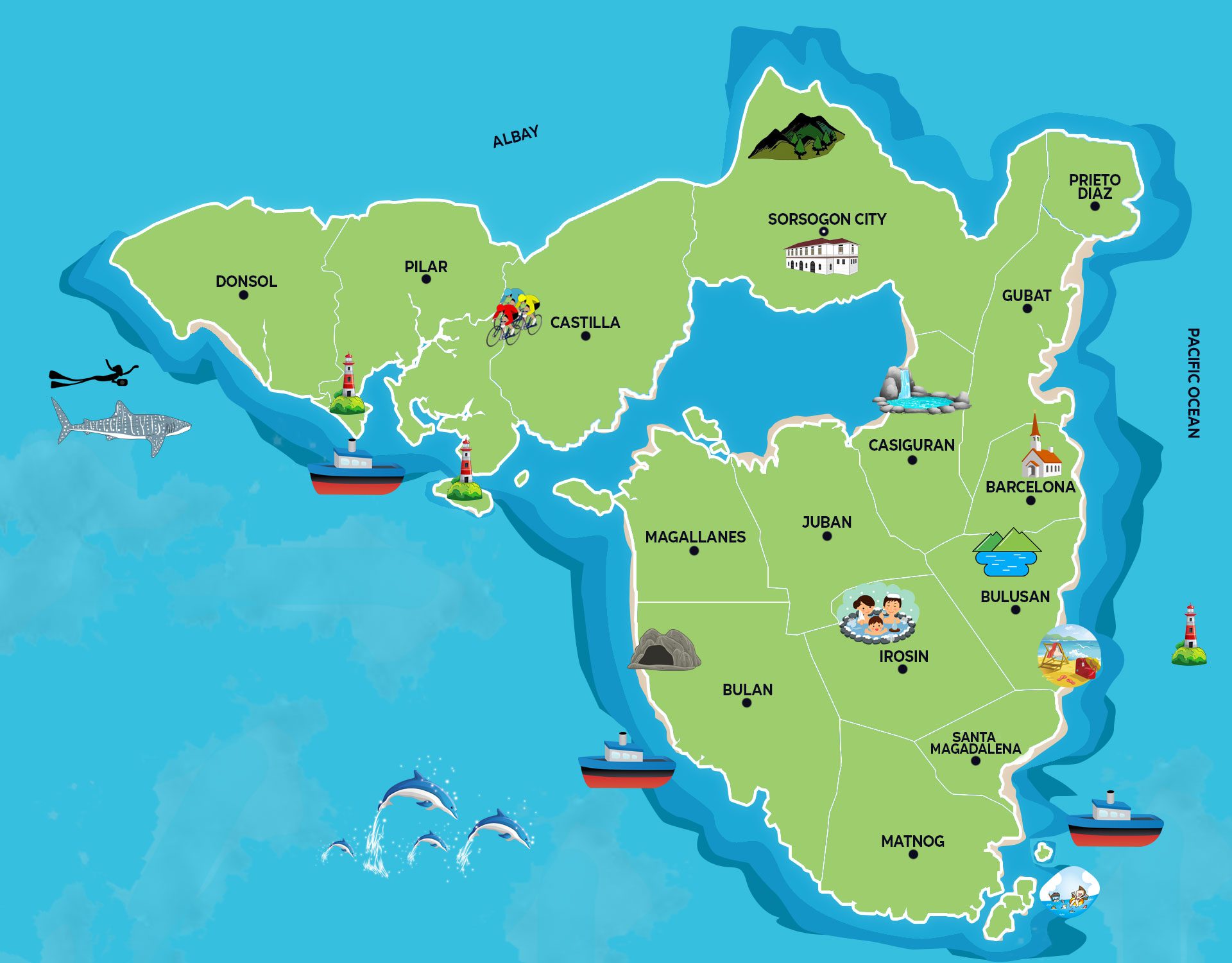
SORSOGON ATTRACTION MAP
Click/Tap the Municipality for more details
DONSOL

Contact Donsol: donsollocalgovtph@gmail.com
Geography
Set in the northwestern part of the province, Donsol is 68 kilometers away from the provincial capitol, with a land area of 16, 631.5358 hectares and is inhabited by almost 49, 711 natives. Like the municipalities in the southern part of the province, the town is noted for its copra and fish.
History
Donsol became a independent town from Albay in 1668. The townsfolks later on petitioned to transfer to sitio Barra for economical benefits, which proved to be right when soon after the transfer in 1831 with the availability if trade, transport and communications had outdone its previous mother town, Quipia. It is said that Donsol got its name from the Spanish term “Don Sol” which for the Spanish meant “Mr.Sun” although there are no records of Donsolanons to ever have had such pagan worship. In another account, it is said that it is derived from the Bicol term “donsolan” or anvil, a heavy metal block used by blacksmiths to make machetes, knives, scissors and the like. It is believed that Donsol was inhabited by expert blacksmiths. Even after the National Museum unearthened a proof of metalworks factory in 1996, what placed Donsol on the map of the world is the gentle giants of the sea, the whale sharks or locally known as butanding. Donsolanons celebrates the arrival of these harmless creatures through Butanding Arribada Festival during the Month of March.
PILAR
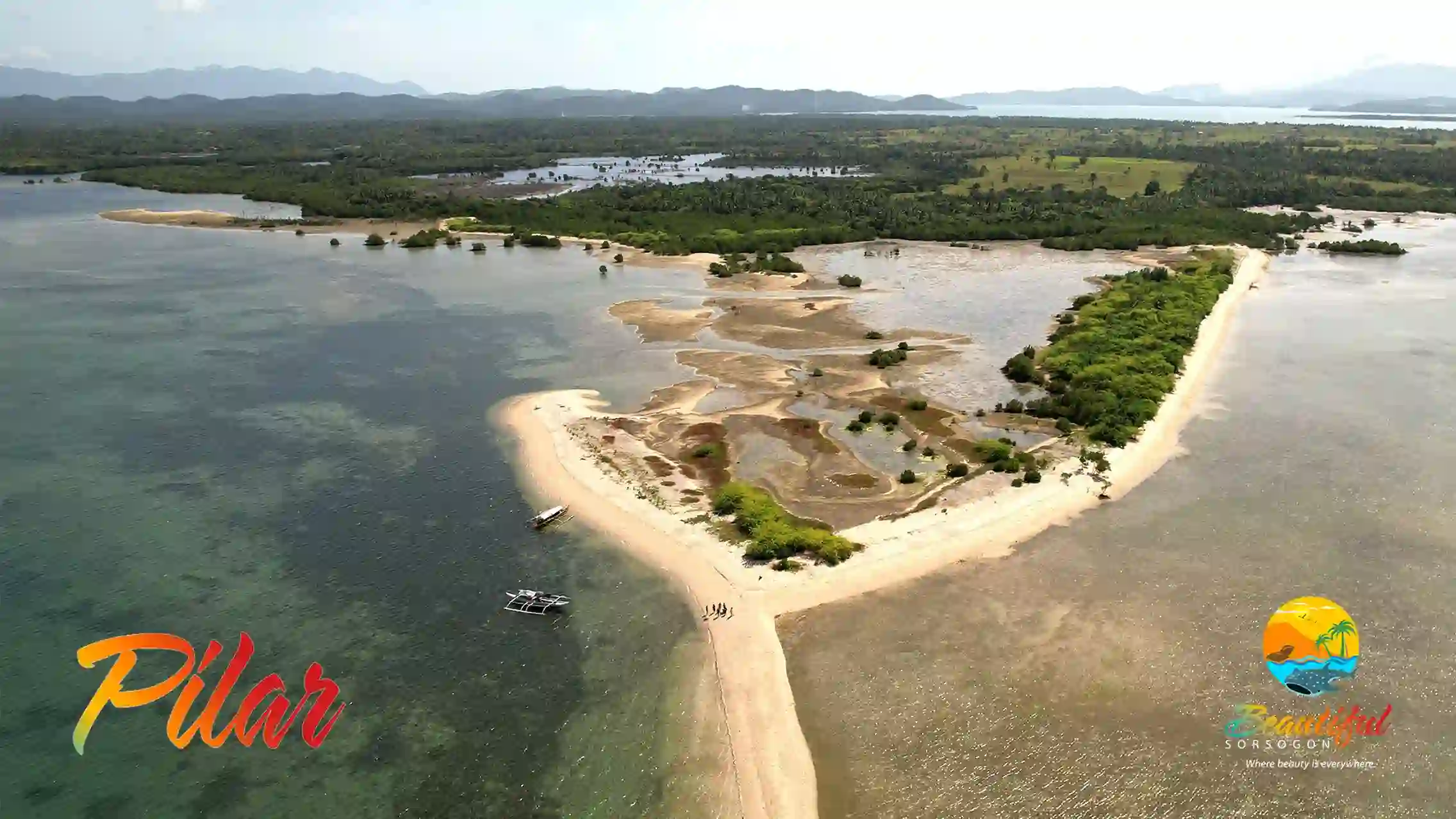
Contact Pilar: pilarsor.mayor@gmail.com
Geography
Located 56 kilometers from the provincial capitol, Pilar has a land area of 20, 513.3654 hectares and is a home to at least 74, 564 people. Reputed to be a shipbuilding town with its menfolks expert in building ships and galleons, in fact Panlatuan, Pilar is considered as one of the bigger shipbuilding sites in this part of Luzon.
History
One of the first Christian settlement in this part of Luzon was established in an area that is now within the territory of Pilar soon after the establishment of Christian settlement in Gibalon, known as Abucay-Catamlangan mission. In 1861, the town was created as a separate town and independent parish from their mother town Cagsaua. The then Governor- General Lemery decreed to unite the adjoining visitas, which included Sto. Niño, Putiao, Sapa, Inang, Candanglogan and Panlatuan to become a new town called Pilar, named after the new born daughter of the king and queen of Spain.
CASTILLA
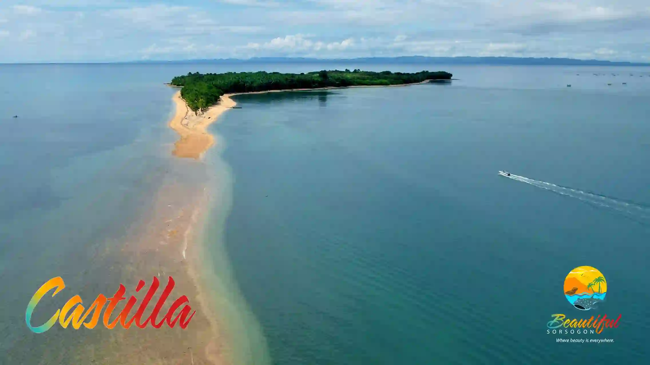
Contact Castilla: progresibonglgucastilla@gmail.com
Geography
Castilla lies along the northern coast of Sorsogon Bay, 25 kilometers from the provincial Capitol. With its 18, 691.7271 hectares of land, it is a home to over 57, 827 locals and is known for forest products like rattan. They also produce root crops such as balinghoy or kamoteng kahoy in addition to its main crop of copra and abaca.
History
Previously a part of Albay, Castilla was organized as an independent town in 1827 at the barrio of Bulabog, which is now a part of Sorsogon. A wealthy and influential Spaniard by the name of Eugenio Santos Martinez, then recommended the transfer of the site to where it is now and also gave its name Castilla, after his hometown in Spain.
SORSOGON CITY
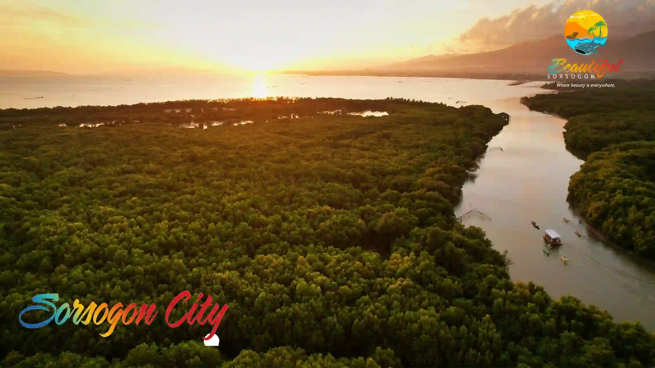
Contact Sorsogon City: mayor.esterhamor.lgusorcity@gmail.com
Geography
The capital city of the province, Sorsogon has become an important commercial center and a port of call for inter-island vessels. With 14, 500 hectares land area home to 792, 949 Sorsogueños. Composed of 1 city and 14 municipalities, it is located at southern tip of the island of Luzon and surrounded by Albay Gulf, Ticao and Burias Pass on the west. San Bernardino Strait and Northern Samar on the Southeast and Pacific Ocean on the East.
History
The town of Sorsogon separated from the province of Albay in 1894 and became the seat of the provincial government having Jose de la Guardia, a Spaniard, as its first Provincial Governor. As a city, Sorsogon the center of commercial, transport hub, religious and educational center of the province. There are several accounts of how the city received its name, the most popular folklore is that a group of Spaniards got lost around the bay and came across a native fisherman whom they asked for the name of the place. The native, thinking they were asking for direction to the nearest village, he points upstream while saying “sosogon” meaning to follow.
PRIETO DIAZ
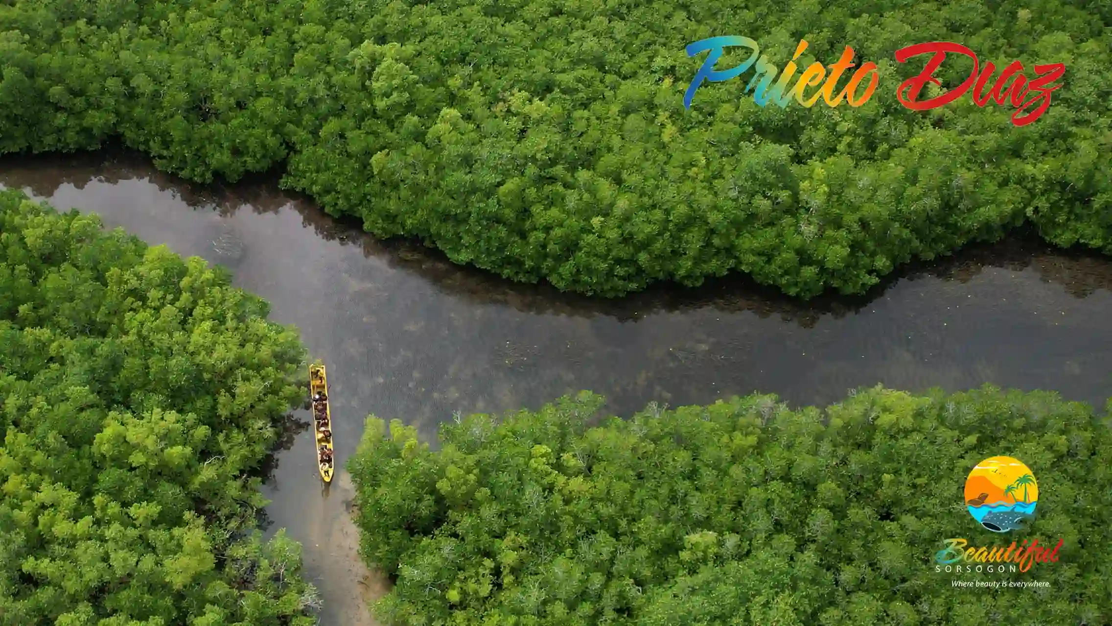
Contact Prieto Diaz: lce.prietodiaz@yahoo.com
Geography
Prieto - Diaz is the second smallest town in the province of Sorsogon, with a land area of 4, 491.1404 hectares, it is a home to 22, 442 locals. On the west and north, it is bounded by the Pacific Ocean and San Bernardino Strait and is popular for its crabs and fish alongside its produce of poultry, abaca and copra.
History
The current site of the town is believed to have been discovered by a hunter named Juan Bontugan who was out on a hunt when he came upon the plain in the middle of the wilderness. He then related his find to the barrio folks and 32 families set to move to the new site. It was then where the barrio was organized and was named after the hunter. In 1879, the name was changed to Montupar, from the local word “topar” meaning where people meet. Prieto- Diaz became an independent municipality in 1904 and renamed after the two priests, Fr. Gabriel Prieto and Fr. Severino Diaz, of the group now known as the 15 Bicol Martyrs (Quince Martires) who were ordered by the Spanish authorities to be executed for rebellion.
GUBAT

Contact Gubat: gubatsorsogon.lgu@gmail.com
Geography
Set in the eastern coast of the province, the town of Gubat is 19 kilometers away from the provincial capitol. With a land area of 17, 690.6618 hectares and a population of more than 59, 534 resides here. Unlike its name, the town is actually popular for its vast white sand beaches and with the boom of the surfing in the area, people from all over the world visits the Buenavista Surf camp to enjoy the waves and the company of the Gubateños.
History
Gubat is said to have been founded by Pedro Manuel Manook, who is believed to be a descendant of Rajah Sikatuna, the chieftain of Bohol and famous for his blood pack with Miguel Lopez de Legazpi. Arriving in Gubat with some of Legazpi’s men, Manook settled in the shores of Gubat. He later on converted to Christianity and was known as Don Pedro Manuel Manook, which the main street of Gubat is named after up to this day. The name Gubat stemmed from a local word meaning “to raid”, this was due to the frequent raids by marauding pirates in the past. Thus, when the first missionaries arrived in 1731, town’s people started shouting “Gubat! Gubat!” and started to running away. The friars then recorded this as the name of the town.
BARCELONA
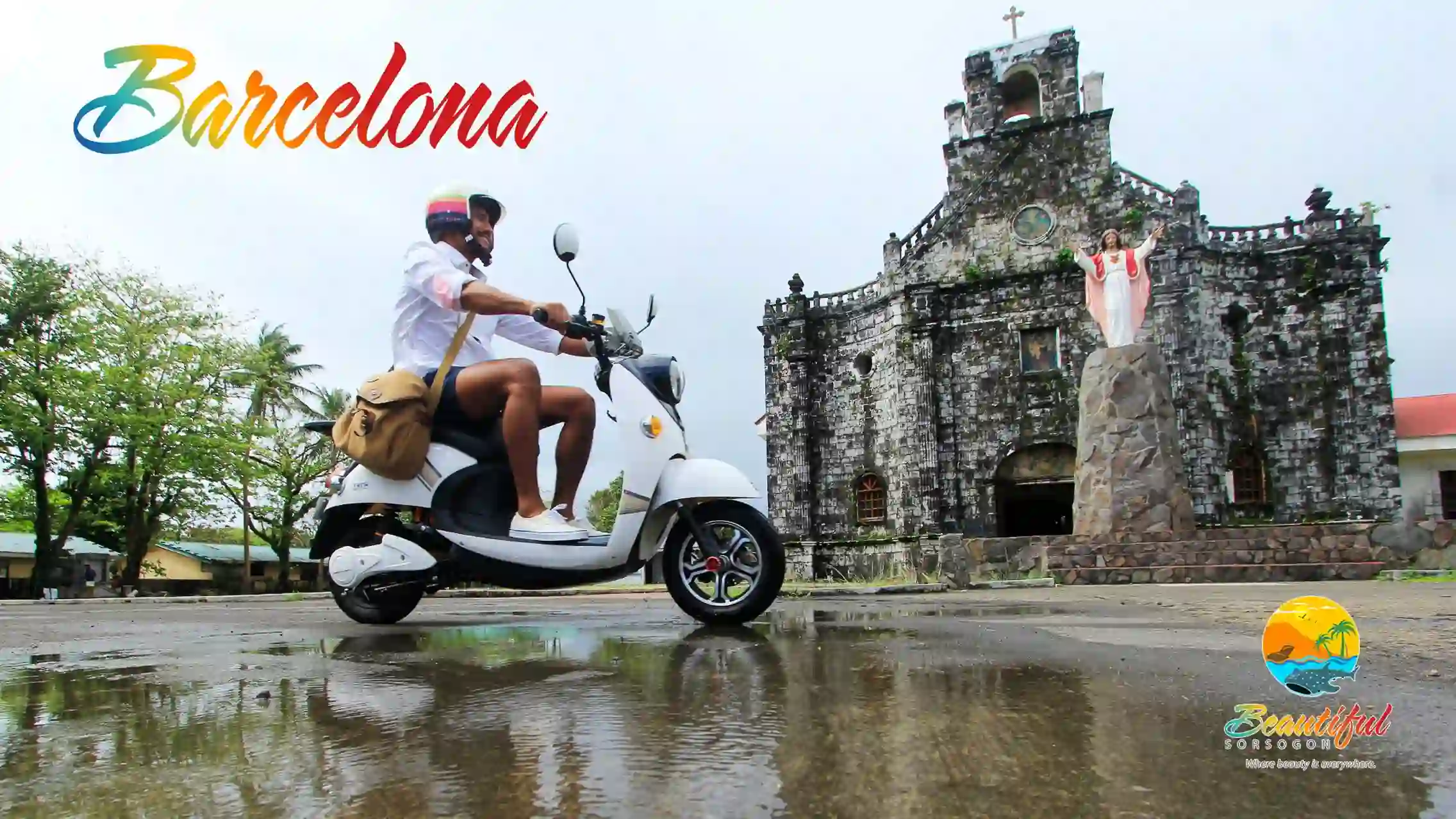
Contact Barcelona: wework.barcelonaph@yahoo.com
Geography
27 kilometers on the eastern coast of the province is the municipality of Barcelona. With a land area of 5, 902.1361 hectares it is the third smallest town in Sorsogon and has a population of 20, 990 locals. Much like other municipalities, Barcelona is noted for its abaca and copra produce and also for hats and mats.
History
Formerly a part of Bulusan and Gubat, this town had a special attachment to the Spaniards who had occupied the land. Through originally known as Danlog, which mean “swift flowing river”, a Spanish official saw the similarity of the land to that of Barcelona, Spain, and recommended to rename the town Barcelona. Because of this, the Spaniards had left an imprint in the town and its townsfolks through its religion, traditions and architectures such as the Presidencia Building, which was destroyed by series of typhoons and eventually abandoned during the Japanese Occupation and the adjacent Stone Building to name a few.
CASIGURAN
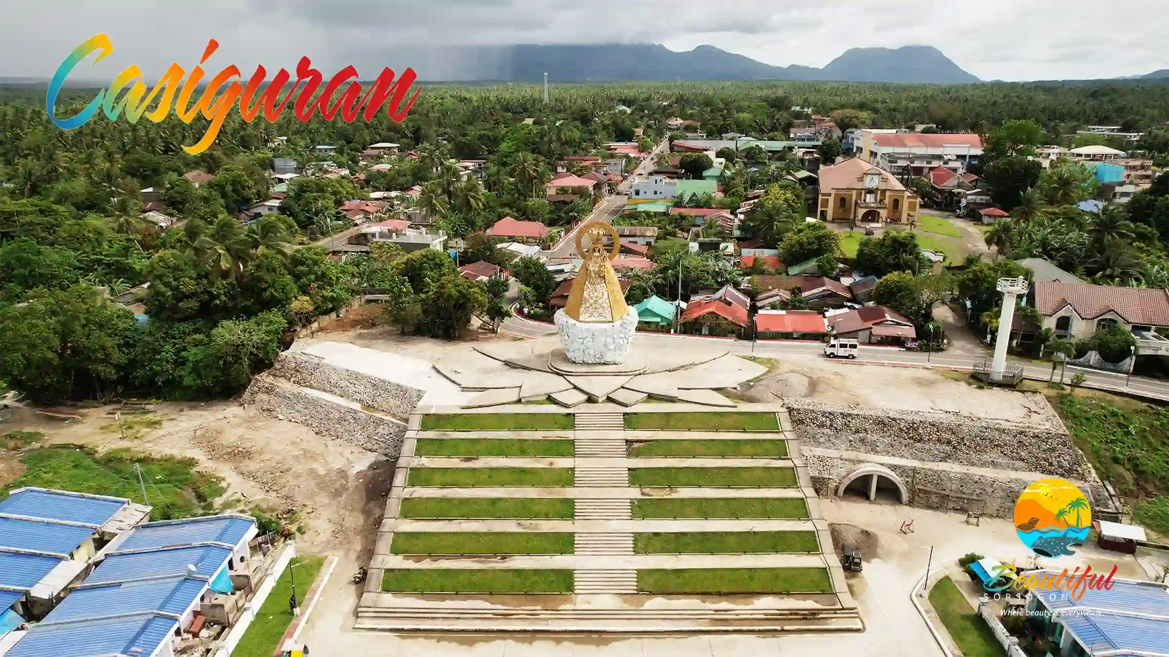
Contact Casiguran: casiguranmio@gmail.com
Geography
A town located at east of Sorsogon Bay and is about 19 kilometers from the provincial capitol. With a land area of 9, 253.7499 hectares with a population of 32, 842. With access water and vast land, the municipality of Casiguran imports products abaca, copra and fish.
History
Casiguran was where the first settlement established by the Spaniards making it the oldest town in the province. It was the center of operations for Ibalon in the early period for Christianization campaign in the southern area of Bicolandia. The name came from the local term casi-gurang, which simply means “mostly aged”, pertaining to the fact that it was the first parish and therefore, the oldest. It is also said the it was populated mostly by senior or elderly folks.
BULUSAN

Contact Bulusan: lgu.bulusan@yahoo.com
Geography
Located at the eastern fringe of the province, Bulusan faces the the Pacific and the turbulent waters of San Bernardino Strait. It is 43 kilometers away from the Provincial Capitol, the municipal is a home to around 72, 884 locals, spread out on its 6, 112.0458 hectares of land. Looming over the town is the active Mt. Bulusan, where one the famous tourist destination in the province is located, the Bulusan Lake, reputed to be one of the most beautiful lakes in the world and was once known to be the “Switzerland of the Orient” and the smaller Lake Agingay located higher in the mountain. The national government has declared the place as a national park in order to protect and preserve its natural ecosystem.
History
It is believed that the civil government of Bulusan began at 1631, same year that it was said to have become a town separated from Casiguran. Bulusan is a Bikol word, meaning, a place where water flow. Living up to its name, Bulusan cascades water down its slopes to numerous springs and rivers around town.
JUBAN
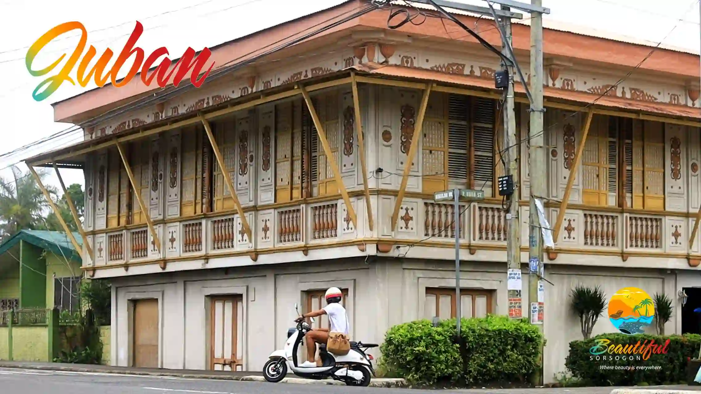
Contact Juban: lgujuban123@gmail.com
Geography
Juban lies about 23 kilometers from the provincial capitol and in its 12, 723.8683 hectares of land dwells more than 32, 230 residents. Similar to its neighboring municipalities, the town also produces abaca and copra.
History
Due to the continuous plundering of Moros, the first settlers of Juban moved to its current location from Cape Cano, a sitio of Casiguran now called Lungib. Passing through the Cadacan River, they formed the town called Binanuaanan. Trees like mili-pili and almasiga grew abundant in the area and the new residents began to collect the sap inside bamboo tubes and later on dried to be used as a light at night. It was this art of collecting sap, called gujub, and the place where grooving was done was called gujuban, is believed where the town’s name originated. Juban is also popularly know to the natives as a haven for witches’ coven. But according to history, in the old days, Juban was home to hilots or herbilarios with their secret herbal conctions and incantations. They are also asked to exorcise evil spirits, this magical powers lead to people calling them aswangs or witches, not meaning to be derogatory, but out of respect and awe. These people are believed to be descendants of shamans or babylans. Despite the magical history of the town, lining their national highway are the well-preserved turn-of-the-century colonial houses or bahay-na-bato. Similar types of houses could be found in the interior of the of the town, making Juban as the only town with may bahay-na-bato still standing and used.
IROSIN
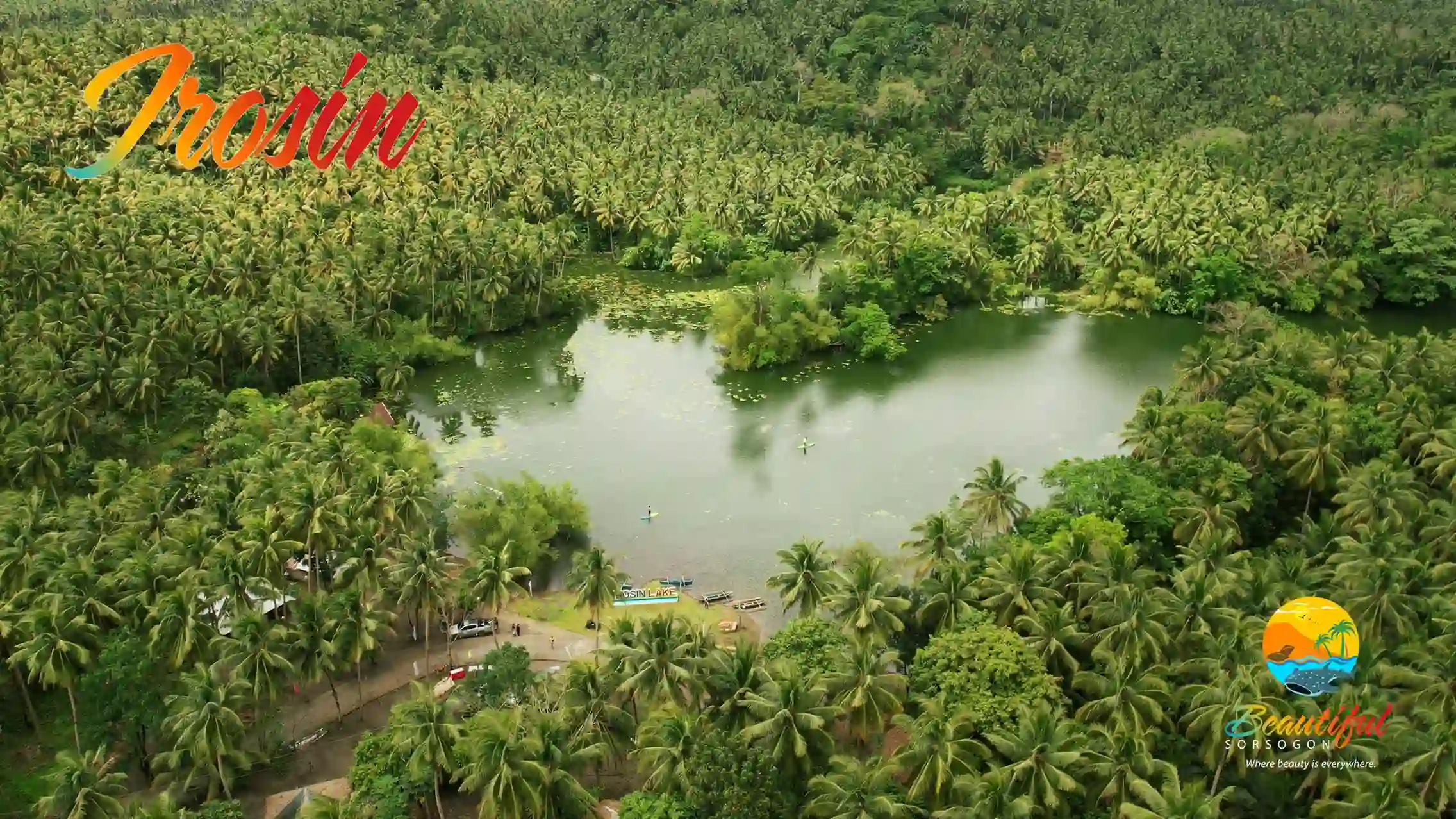
Contact Irosin: municipalityofirosin@gmail.com
Geography
The only in land municipality, Irosin has a land area of 16, 721.5893 hectares occupied by more than 56, 662 residents and occupies the central eastern portion of the province. Believed to be set in a caldera, or a cauldron- like depression created by a volcanic eruption. According to volcanologists, Mt. Bulusan is not the actual volcano but a fracture of a bigger volcano, the crater of which created the valley of Irosin. Which explains the fertile land and has gained he reputation as the rice granary of the province.
History
The town of used to be a part of Bulusan and was then known as Hinan-ay, a native term pertains to the way the abaca fibers was arranged when weaved. Only after it was it became an independent town in 1880 when it was renamed to Irosin, derived from the Bicol word “iros”, meaning to cut off a part or tear down. This refers to the fact that the town, being landlocked and surrounded by mountains, bear witness to several landslides or erosions due to river flows or earthquakes.
MATNOG
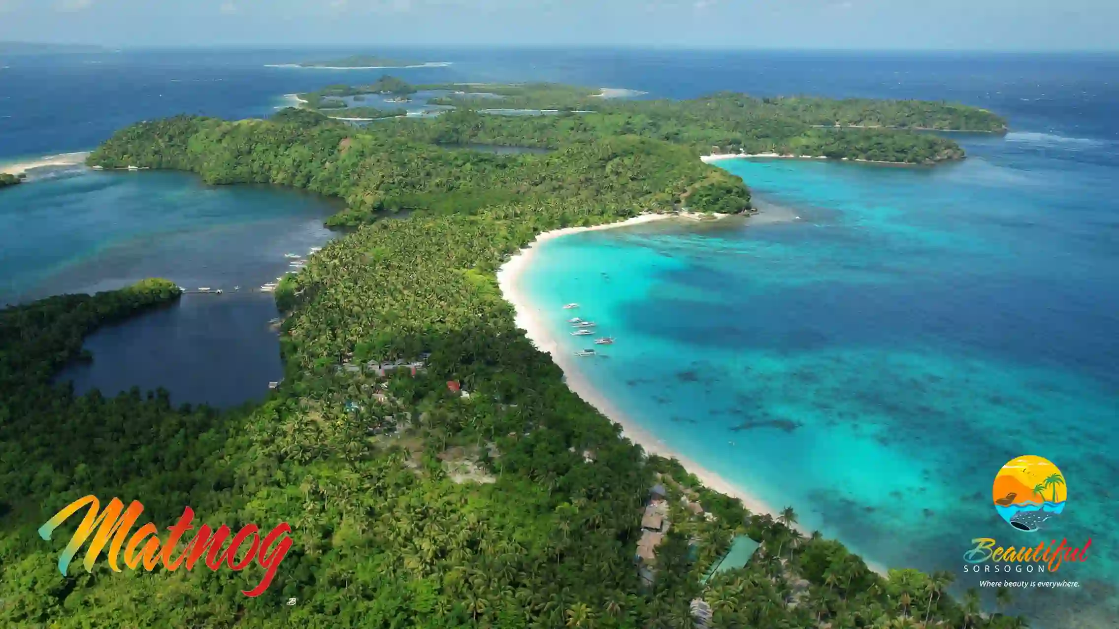
Contact Matnog: matnogsorsogon.lgu@gmail.com
Geography
With a land area of 14, 810.555 hectares, Matnog occupies the southernmost tip of the island of Luzon and is located 71 kilometers from the Provincial Capitol. Home to 41, 101 locals, the town is noted for its lumber and other forest products along with fish, nipa shingles as well as abaca and copra.
History
It is believed that the first settlers of this town were cavemen from Bacon, followed by the arrival of civilized Malays, led by Sirangan, the chief, and his wife, Hara-hara, who made their way here long before 1570. The original site where their tribe presumably settled was near the mouth of Matnog River, now known as Banuangdaan. From its original site, the town was transferred to where it is now on the year 1898. The name Matnog is said to have come from the local word “matonog” referring to the loud sound coming from the seas surrounding the town.
MAGALLANES
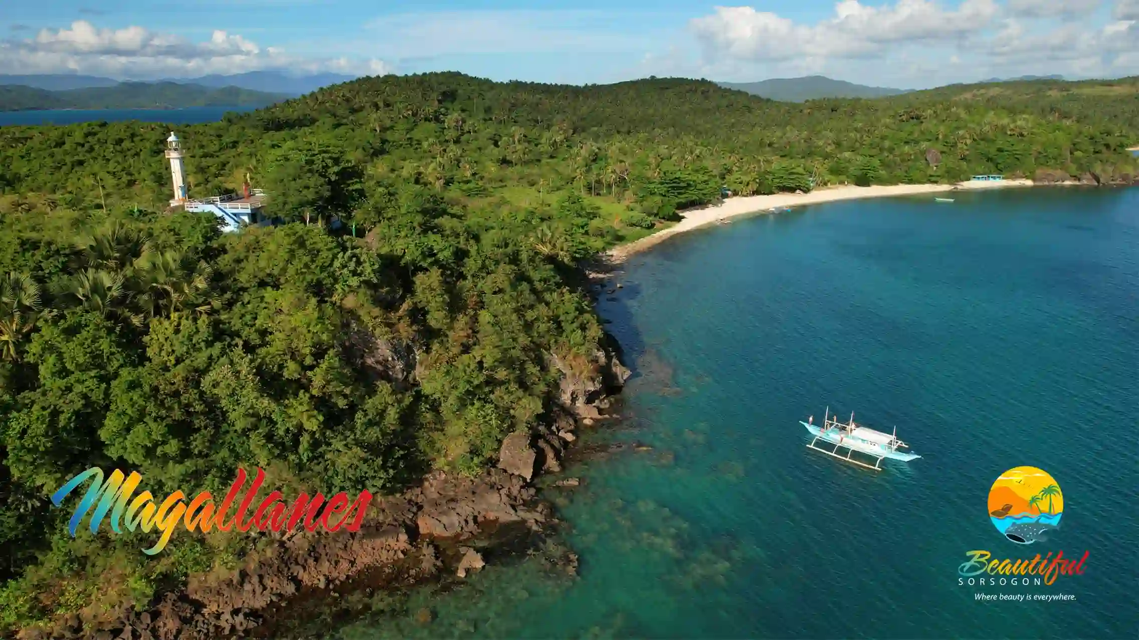
Contact Magallanes: contact@magallanessorsogon.gov.ph
Geography
With a land area of 10, 933.5285 hectares, Magallanes is a home to 37, 038 locals and is noted for their fresh and dried fish along side its produce of copra and abaca. it lies in the entrance of Sorsogon Bay and is 47 kilometers away from the provincial capitol.
History
Magallanes is known for the town of Gibalong where the first Christian mass and the birth of Christianity in Luzon was celebrated. It is also here where the first Christian settlement in this part of the country was established. Recently, the province had celebrated the 450th Anniversary of the mass in Gibalon and had erected a galleon marking the location of the said event. It also in Magallanes where the Bagatao Island is located. It was one of the biggest astillero or shipyards during that time and was called Real Astillero de Bagatao or Royal Shipyard of Bagatao, it is where some of the biggest and majestic Spanish Galleons such as the Nuestra Señora del Buen So corro were built. Magallanes, use to be known as Parina, was part of the Encomienda de Yguey until Don Manuel de Castro alongside the natives of the town, the Spanish government approved the establishment of Magallanes as a new town on the 30th of April, 1859. De Castro then became the first gobernadorcillo of the town and named it after the circumnavigator of the world, Don Fernando/ Hernando de Magallanes.
BULAN
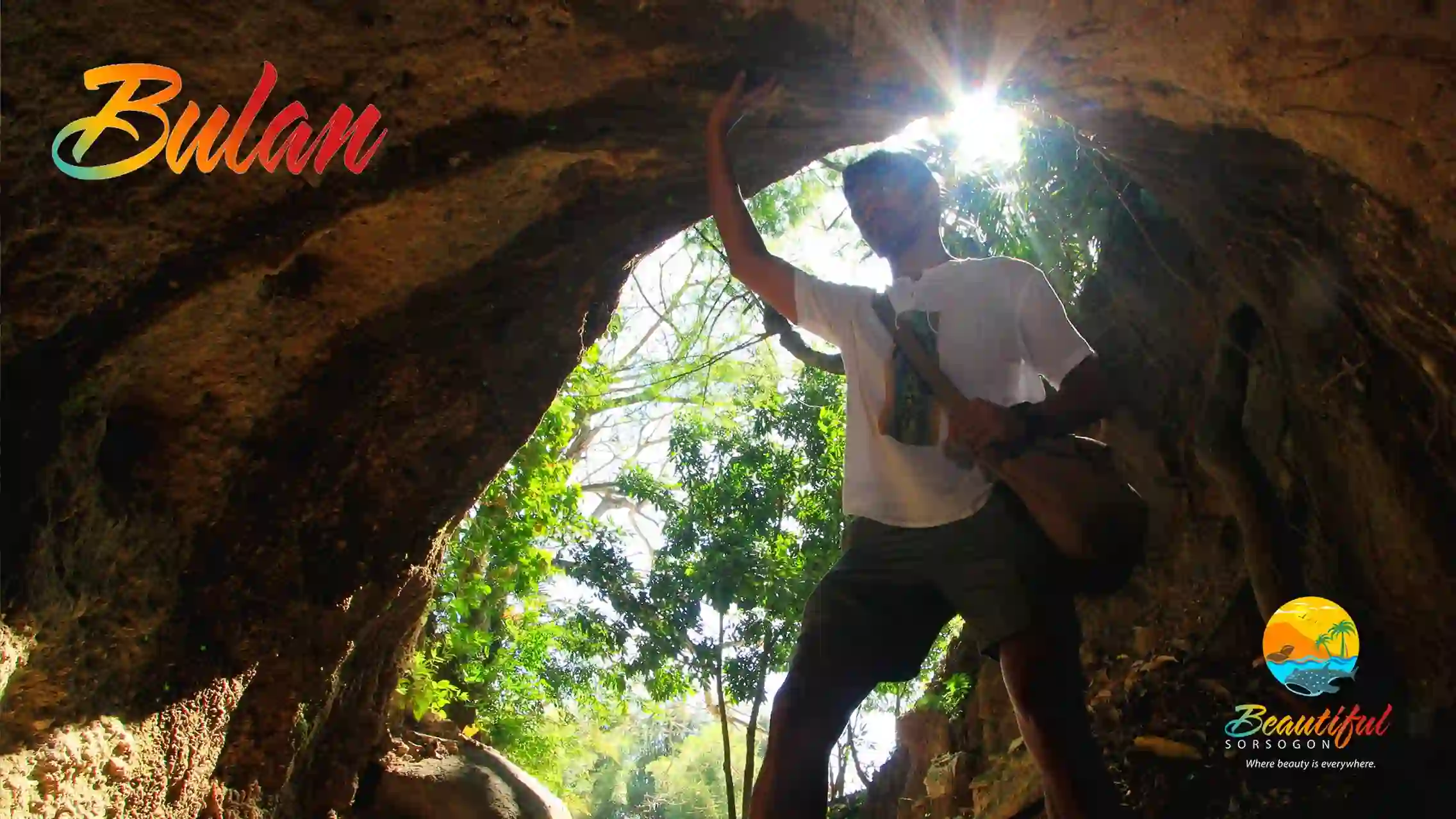
Contact Bulan: lgubulan@gmail.com
Geography
As one of the biggest towns in Sorsogon, the municipality of Bulan has a land area of 21, 502.5624 hectares and a home to more than 100, 076 Bulaneños. It is 63 kilometers away from the provincial capitol southwestern coast of the province. Aside from the main products of the province such as pili and abaca, Bulan is more popular for its fish, sawali and rice.
History
There are several accounts of how the town got its name. In one account, it was during an expedition of the Spaniards along with a few natives from the old seaport of Ticao sailing northward when they were overwhelmed by the beauty of the big moon. Remembering their glee of seeing the majestic view the Spaniards named the town “Bulan” when they landed. In another account, similar to that of Sorsogon history, when two fishermen ashore were distributing their catch was approached by Spaniards and asked about the place. Thinking they were being asked about the full moon rising in the east, they answered, “Bulan”. However, in some Spanish maps, it is written as Builan, but none knows what it meant and is later believed that in time I was dropped and simply became Bulan or the “Moon Town”.
SANTA MAGDALENA
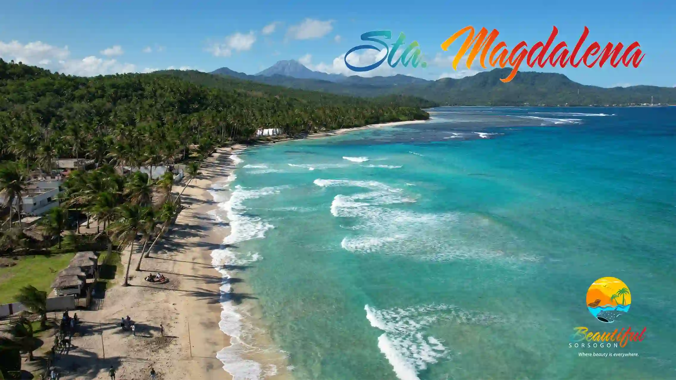
Contact Sta. Magdalena: lgu.smmo@gmail.com
Geography
The smallest town in the province of Sorsogon with a land area of 5, 731.1299 the municipality of Magallanes is a home to more than 16, 848 locals and is located 72 kilometers east of the Provincial Capitol. The town is noted for fish, copra and abaca and in recent years has been popular for its white sand beaches.
History
Originally named Busaingan a local term meaning where the waves break, pertaining to the huge waves that break and smash in the rock wall along the shore. It wasn’t until early 20th century did the parishioners decided to have St. Mary Magdalene as its patron for their parish and also chose to change the name of their town to Santa Magdalena.